Moon, Tides, and Warm Water: The Science Behind Planning a Perfect Beach Day in the DR
You've booked the flights, locked in the hotel, and you're ready to spend every possible hour on a Dominican beach. Smart move. But here's something most visitors never think about until they're already standing ankle-deep in murky water wondering what went wrong: the ocean doesn't care about your vacation schedule.
The Dominican Republic's coastline — stretching across the Caribbean on the south and the Atlantic on the north — is shaped by forces that have nothing to do with hotel ratings or resort amenities. Lunar cycles, tidal patterns, and shifting water temperatures all play a direct role in how clear the water looks, how rough the surf gets, and whether that snorkeling trip is going to be spectacular or a total wash. Once you understand these rhythms, you can plan your beach days around them instead of just hoping for the best.
Why the Moon Matters More Than the Weather Forecast
Tides in the Dominican Republic are relatively modest compared to, say, the Bay of Fundy — but that doesn't mean they're irrelevant. The DR experiences semidiurnal tides in most coastal zones, meaning two high tides and two low tides every 24 hours. The difference between high and low water can range from about a foot to nearly two feet depending on the region and the time of month.
Here's where the moon comes in. During a new moon or full moon, the gravitational pull of the sun and moon align, producing what are called spring tides — stronger tidal swings that push water higher at high tide and pull it lower at low tide. During the quarter moon phases, you get neap tides, which are calmer and more moderate.
For beach planning, this matters in a few concrete ways:
Water clarity: Low tide on a spring tide cycle can stir up more sediment in shallow areas, temporarily reducing visibility for snorkelers. If you're planning to hit a spot like Playa Frontón or the reefs near Bayahibe, aim for the rising tide window — roughly two hours before high tide — when water tends to be clearest and calmer.
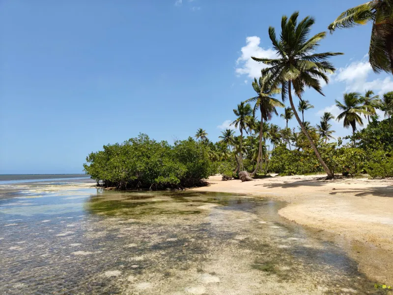
Beach size: Low tide reveals significantly more sand at many DR beaches. If you want the widest stretch of beach to yourself, low tide mornings are your friend. At places like Playa Rincón on the Samaná Peninsula, the difference in exposed sand between high and low tide is genuinely dramatic.
Surf conditions: On the north coast, around Cabarete and Playa Grande, tidal changes interact with Atlantic swells in ways that affect wave size and consistency. Surfers and kitesurfers in the know track these patterns obsessively. Even if you're not riding waves, understanding when the surf peaks can help you decide when it's safe to swim versus when you should stick to sunbathing.
Seasonal Water Temperatures: Not All Months Feel the Same
The Dominican Republic sits in the tropics, so the water is warm year-round — but "warm" covers a wider range than most people expect. Caribbean-side water temperatures typically run between 77°F in late winter and up to 86°F or higher in late summer. The Atlantic north coast runs a few degrees cooler on average and is more subject to seasonal variation.
For most American travelers, this distinction only matters at the extremes. January and February water temps on the north coast can feel noticeably cool after a few hours — not cold by New England standards, but enough to cut a snorkeling session short. If you're visiting in those months specifically for water activities, the southern and eastern coasts (Punta Cana, La Romana, Bayahibe) will serve you better.
By contrast, August and September bring peak water temperatures island-wide. The Caribbean side can feel almost bath-like, which is wonderful for floating around but worth noting if you're planning extended dives — warmer water holds less oxygen and can affect how long some people feel comfortable staying under.
The sweet spot most people miss: April through June hits a kind of Goldilocks zone on both coasts. Water temperatures are warm but not oppressive, visibility is typically excellent because there's less wave-driven sediment disturbance, and marine life activity — including sea turtles, reef fish, and even whale sharks on rare occasions — tends to be high. This window also falls outside peak tourist season, which means you're competing with fewer people for the same stretch of beach.
Reading the Tidal Calendar for Your Specific Trip
You don't need to be a marine biologist to use this information. Free apps like Tide Alert, Tides Near Me, or even the NOAA Tides and Currents site will give you accurate tidal predictions for Dominican coastal zones. Before your trip, pull up the tidal calendar for your specific destination and look for patterns.
A few practical rules of thumb:
- Plan your snorkeling for incoming tides. Water clarity is generally best as the tide rises toward high. Avoid snorkeling immediately after a low tide in shallow reef areas.
- Chase calm mornings on new or full moon weeks. Spring tide windows can produce glassy, calm water early in the morning before wind picks up — especially on the Caribbean side.
- Watch for full moon nights. If you happen to be in the DR during a full moon, night swims and moonlit beach walks are genuinely magical. The added light also makes it easier to spot bioluminescent plankton in certain bays, particularly around Las Galeras and some of the quieter lagoons near Miches.
- Don't ignore the wind. Tides and temperatures are only part of the equation. Trade winds on the north coast can dramatically affect wave height regardless of tidal phase. Cabarete is windy almost by definition — that's what makes it a kite-surfing mecca. But on calmer, wind-sheltered bays, tidal timing becomes the dominant factor in conditions.
Regional Differences Worth Knowing
Not all Dominican coastline behaves the same. A few regional notes that affect how lunar and tidal factors play out:
Punta Cana / Bávaro: Protected by a natural barrier reef, this stretch is relatively calm regardless of tidal phase. Tidal variation here is among the smallest on the island. Water clarity is generally consistent, though it can cloud up after heavy rain or strong onshore winds.
Samaná Peninsula: More tidal variation than the southeast, and more dramatically affected by lunar cycles. The bay itself partially shelters beaches like Las Terrenas from Atlantic swells, but tidal timing still affects beach width and water clarity noticeably.
North Coast (Cabarete, Playa Grande, Río San Juan): Atlantic-facing and subject to bigger swells. Tidal phase matters less here than wind direction and swell period. Water temperatures are cooler in winter months.
Southwest (Barahona, Pedernales): Less visited and less documented, but this coast is known for exceptionally clear water during calm periods. Because it's sheltered from Atlantic systems, tidal and lunar effects on clarity can be quite pronounced — meaning the difference between a great visibility day and a poor one often comes down to exactly where you are in the tidal cycle.
The Bottom Line
The weather forecast tells you about rain and sun. It doesn't tell you whether the water will be clear, whether the beach will be wide or narrow, or whether the reef you're planning to snorkel will be worth the trip. Lunar cycles and water temperatures do. Spend five minutes with a tidal calendar before your trip and you'll be making smarter decisions than 90% of the tourists who show up and just hope for the best. The DR's beaches are spectacular under any conditions — but they're something else entirely when you catch them at the right moment.